This kicks off a series of posts about GIS tools and data. I’ve wanted to do something like this for a while now, but am finally forcing myself to do more writing to get back into the habit. So to start off, I’d like to go through a brief history lesson to discuss where GIS was and where it is today. I’ve had a long history in the GIS field, spending most of my professional career working for a government mapping agency where I wrote production systems and then transitioned into a research and development mode. So on to Part 1.
In days of old (OK, only around a decade or three ago), getting into the geospatial field could be a costly endeavor. Most data were locked up in proprietary vaults and you had to pay for access to them, if you could get access at all. The world had just started to transition from paper maps and traditional cartography to applying technology to mapping tasks. With the less advanced technology of the day, transcribing paper maps into a digital representation was a labor-intensive task and required many hours of work. In many cases, creating vector data involved someone drawing vectors on top of an on-screen image of a paper map (which sadly, is still one of the main methods in use today!).
There was also a lot of confusion in the early days about how to do digital mapping in the first place. Most of the people involved came from paper mapping and had spent decades learning how things worked in a physical world. The move to digital changed things. Accuracy in the paper world was no longer sufficient in digital, as what looked like it lined up on paper actually didn’t line up in digital. You could zoom in with a computer and see how far things actually were from lining up. There was a lot of resistance in the early years as mappers did not think using computers was “real” cartography.
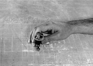
As an example, consider how paper maps were printed. They used multiple Mylar plates that contained various parts of the map. When the map was printed, the plates would be inked and roll against the paper to lay down the layers (colors) of the map. These plates were aligned by the use of stud holes that were cut into the Mylar so they could be positioned correctly during the printing process. When these plates were scanned in and referenced, they did not line up. In the analog world, a gap of a millimeter or so would not really show up on the paper map. In digital, however, that gap will stand out like a sore thumb when the digital map separates are combined in a GIS.
GIS tools themselves were expensive and were mainly only available from two vendors. Additionally, these tools were really only available on Windows and proprietary UNIX platforms such as Solaris and IRIX. Using them was difficult and required users to have an in-depth understanding of geospatial data and how to use the tools. Many people had to take week long vendor classes before they could use them. And of course, most of the tools had to be run from the command line.
Then things began to change. GPS was opened up to the public and for the first time mapping became dynamic for the non-GIS user. As GPS advanced, they became equipped with moving map displays so people could actually see where they were on a map and could see what was around them.
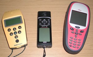
Early GPS, however, also suffered the same issues as early GIS systems. In the beginning they were bulky and only gave you your latitude and longitude on a digital display. This was OK for some people, as they could look at a paper map to reference where they were. They were expensive and only came from a handful of vendors. These early units had accuracy issues, the major being the intentional inaccuracy mandated by the US government who were afraid they could be used against America. They were very dependent on line of sight and took a while to get a general lock (which then meant they were accurate to the tens of feet instead of a foot or two).
GPS and GIS technologies began to evolve. GIS software got better and became more user friendly, making use of GUI technologies of the day. GPS technology evolved and became faster and smaller so that people could use hand held units to venture into the outdoors. GIS professionals began to try to hook up their software systems to a GPS so they could use their data with real-time measurements. Companies then got the bright idea to sell software so that you could hook a GPS to your laptop and then watch your location in real time on the screen. It was clunky and hard to use, but was the direct ancestor of every system we take for granted today.
Next time I’ll discuss the rise of Open Source GIS tools and data.


